

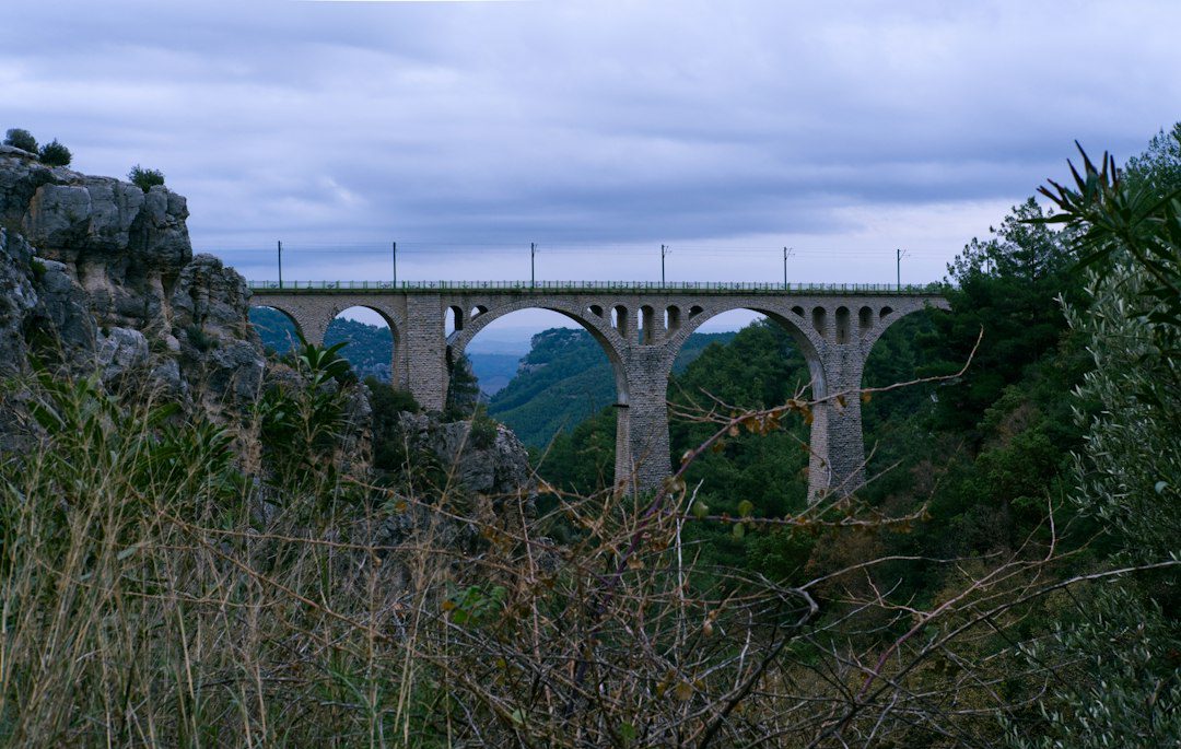

Çamlıhemşin is a compact gateway to one of Türkiye’s most dramatic landscapes: the Fırtına Valley, stone arch bridges, Zil Kale, Ayder Plateau and the forested approaches to the Kaçkar Mountains. It rewards travellers who slow down, accept changing mountain weather and plan transport carefully.
Featured image: Ilker Ozmen via Unsplash.
This Çamlıhemşin travel guide is designed for a two- or three-night Black Sea stay. It does not treat the highlands as a checklist. Instead, it combines cultural heritage, short nature stops, local food and realistic decisions about roads and season.
Why visit Çamlıhemşin now?
Two recent global studies help explain the appeal of a place like Çamlıhemşin without proving local demand growth. Booking.com’s Travel & Sustainability Report, published on 20 April 2026, found broad interest in off-peak and cooler-destination travel. Hilton’s 2027 Trends Report, published on 29 September 2026, highlighted shorter, flexible trips, trusted human expertise and wellness connected with nature. Çamlıhemşin fits those preferences when planned as a weather-aware valley stay—not as a promise of empty roads or guaranteed sunshine.
Where is Çamlıhemşin?
Çamlıhemşin lies inland from Türkiye’s eastern Black Sea coast in Rize Province. The Fırtına River corridor leads south from the coastal road toward the district centre, Ayder and the Kaçkar Mountains. Rize–Artvin Airport is the nearest major air gateway for many itineraries, but transfer time depends on road, traffic and weather conditions.
Top places to see
Fırtına Valley and stone arch bridges
The river and its side valleys form the journey’s spine. Historic stone bridges, tea gardens and forested slopes create frequent stops, but road shoulders can be narrow. Photograph only from safe pull-offs and never block local traffic. Commercial rafting operates in the valley, yet water levels, weather, operator standards and traveller suitability must be checked directly.
Zil Kale
Zil Kale stands above the Fırtına Valley on a historic route. The Rize Provincial Directorate of Culture and Tourism identifies it as an important Çamlıhemşin monument. Expect steps, uneven stone and exposed viewpoints. Check current access and opening arrangements locally before departure.
Ayder Plateau
Ayder is the region’s best-known plateau settlement and an access point for the northern Kaçkar landscape. The official Rize plateau guide places it 19 kilometres southeast of Çamlıhemşin and notes varied accommodation, waterfalls and mountain approaches. It is developed and popular, so travellers seeking solitude should not assume a remote-village atmosphere.
Pokut and Sal plateaus
These higher settlements are known for traditional wooden architecture, mist and broad mountain views. Access is the key issue: roads may be rough, visibility can change quickly and conditions differ by season. A suitable local vehicle and experienced driver may be necessary. Never add a high plateau simply because it looks close on a map.
Kaçkar Mountains National Park
The national park protects a high-mountain environment with steep valleys and rich plant life. Day walks range from easy local paths to serious mountain routes. Trail choice should match weather, snow, fitness and navigation skills. Independent visitors should seek current local advice; technical or remote routes warrant a qualified guide.
A realistic three-day itinerary
Day one: coast to Çamlıhemşin
Arrive via the Black Sea coast, stop at one or two safe viewpoints in the lower Fırtına Valley and settle into your accommodation. Keep the first day light; delays are common when flights, weather and narrow roads interact.
Day two: heritage valley route
Travel toward Şenyuva, a stone bridge and Zil Kale, adding a waterfall only if current road and access conditions allow. Return early enough for an unhurried dinner. This is a better day for heritage and valley scenery than for trying to combine distant high plateaus.
Day three: Ayder or a high-plateau decision
Choose Ayder for easier services and a gentler day. Choose Pokut/Sal only with confirmed road access, appropriate transport and a realistic weather window. If clouds close in, substitute a village meal, tea-focused stop or short lower-valley walk rather than forcing the ascent.
When to go
Late spring
Valleys are green and water is lively, but rain, mud and lingering snow can affect higher roads and trails. Treat high-plateau access as conditional.
Summer
Summer generally gives the broadest range of visitor services, but popular corridors can be busy. Start early and allow time for traffic on narrow roads.
Early autumn
Early autumn can suit cooler walks and food-focused travel. Daylight shortens and mountain weather remains changeable, so keep the itinerary compact.
Winter
Winter changes the trip completely. Snow, ice and closures can make high routes unsuitable. Visit only with current local advice, the right vehicle and plans that can change.
What to eat
Look for regional Black Sea dishes such as muhlama/kuymak, corn bread, beans, seasonal greens, trout and Laz böreği. Menus vary by household, season and restaurant. Our Black Sea cuisine guide gives broader context. Ask what is prepared locally and confirm dietary restrictions in advance; dairy, butter, corn flour and nuts may feature prominently.
Where to stay
Choose the district centre or lower valley for road convenience; Ayder for more established visitor infrastructure; or a village guesthouse for a quieter, locally hosted stay. “Bungalow” describes many very different properties, so verify the exact location, road access, heating, sound insulation, accessibility and cancellation terms before booking.
Transport and road reality
- Do not judge drive time by distance alone.
- Confirm whether your rental-car agreement permits the roads you intend to use.
- Use an experienced local driver for rough highland routes.
- Keep luggage compact if changing vehicles or staying in hillside accommodation.
- Download maps, but do not rely on phone coverage in every valley.
- Check forecasts and local road advice each morning.
Responsible travel in the highlands
Stay on existing paths, carry rubbish out, keep noise low and ask before photographing residents or homes. Do not fly a drone without checking national, local and site-specific rules. Support locally run accommodation and food businesses, but avoid entering private land for a photograph. The landscape is lived in, not staged.
Combine Çamlıhemşin with the eastern Black Sea
A wider route can continue to Artvin, or west toward Sümela Monastery with appropriate transfer time. For a broader introduction, start with the Turkey travel guide. Avoid linking distant sights into one rushed day; the Black Sea’s roads and weather reward shorter stages.
Plan a tailored Çamlıhemşin trip
Travel Agency Türkiye can help shape a private or group route around your dates, walking ability and comfort level, subject to confirmed local services. Use Plan My Trip for a personal itinerary, or review our Türkiye DMC services for agency, incentive and group support. You can also compare wider Turkey package tours.
Çamlıhemşin FAQs
How many nights do I need?
Two nights allow a compact valley visit; three nights provide more resilience for weather and a choice between Ayder and a higher plateau.
Can I visit without a car?
Reaching the region is possible, but dispersed sights and variable highland access make a pre-arranged driver or tour practical for many visitors.
Is Ayder the same as Çamlıhemşin?
No. Ayder is a plateau settlement within Çamlıhemşin district, reached by road from the district centre.
Are Pokut and Sal always accessible?
No. Road and weather conditions vary. Confirm access locally and use a suitable vehicle and driver.
Is Çamlıhemşin suitable for children?
It can be, especially with a slow valley-based plan. Use age-appropriate walks, secure child seats and extra caution near rivers, steps and unfenced viewpoints.
2 Comments